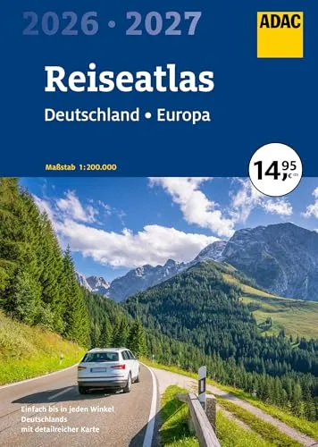
ADAC Reiseatlas 2026/2027 Deutschland & Europa - Praktischer Reiseatlas im Maßstab 1:200.000 für Deutschland und 1:4,5 Mio. für Europa, ideal für Roadtrips und Urlaubsplanung.
- Hersteller: ADAC
- Farbe: blau|grau
Preisvergleich ab 14,95 € bis 14,95 €
-
Bestes Angebot

ADAC Reiseatlas 2026/2027 Deutschland 1:200.000, Europa 1:4,5 Mio. (ADAC Atlas)
ADAC Reiseatlas 2026/2027 Deutschland 1:200.000, Europa 1:4,5 Mio. (ADAC Atlas)

14,95 €
zzgl. 0,00 € VersandADAC Reiseatlas 2026/2027 Deutschland 1:200.000, Europa 1:4,5 Mio. (ADAC Atlas)
ADAC Reiseatlas 2026/2027 Deutschland 1:200.000, Europa 1:4,5 Mio. (ADAC Atlas)
-

ADAC Reiseatlas 2026/2027 Deutschland 1:200.000, Europa 1:4, ... 9783826423888
Autor: Keine Angabe, Buchtitel: ADAC Reiseatlas 2026/2027 Deutschland 1:200.000, Europa 1:4,5 ..., Einband: Taschenbuch, Erscheinungsjahr: Jun 2025, Fachbereich: Hardcover/Reise/Karten, Stadtpläne, Atlanten/Europa, Film-/Fernseh-Titel: Keine Angabe, Format: 291x207x16 mm, Gewicht: 650, Interpret: Keine Angabe, Musiktitel: Keine Angabe, Produktart: Bücher, Publikationsname: ADAC Reiseatlas 2026/2027 Deutschland 1:200.000, Europa 1:4,5 ..., Publikationstitel: ADAC Reiseatlas 2026/2027 Deutschland 1:200.000, Europa 1:4,5 ..., Seiten: 288, Sprache: Deutsch, Verlag: ADAC Verlag Gmbh

14,95 €
zzgl. 0,00 € VersandADAC Reiseatlas 2026/2027 Deutschland 1:200.000, Europa 1:4, ... 9783826423888
Autor: Keine Angabe, Buchtitel: ADAC Reiseatlas 2026/2027 Deutschland 1:200.000, Europa 1:4,5 ..., Einband: Taschenbuch, Erscheinungsjahr: Jun 2025, Fachbereich: Hardcover/Reise/Karten, Stadtpläne, Atlanten/Europa, Film-/Fernseh-Titel: Keine Angabe, Format: 291x207x16 mm, Gewicht: 650, Interpret: Keine Angabe, Musiktitel: Keine Angabe, Produktart: Bücher, Publikationsname: ADAC Reiseatlas 2026/2027 Deutschland 1:200.000, Europa 1:4,5 ..., Publikationstitel: ADAC Reiseatlas 2026/2027 Deutschland 1:200.000, Europa 1:4,5 ..., Seiten: 288, Sprache: Deutsch, Verlag: ADAC Verlag Gmbh
-

Reiseführer ADAC Reiseatlas 2026/2027 Deutschland 1:200.000, Europa 1:4,5 Mio. diverse
Bestens zurechtfinden in Deutschland mit dem ADAC Reiseatlas : Detailmaßstab 1:200.000 : Leichte Navigation durch Deutschland Maßstab 1: 4,5 Mio.: Planungskarte Europa Der ADAC Reiseatlas bietet die perfekte Orientierung für Deutschland im Detailmaßstab. Neben der modernen Kartografie haben wir zusätzlich staugefährdete Strecken hervorgehoben . Mit den Cityplänen im Maßstab 1:20.000 finden Sie sich auch in hektischen Innenstadtbereichen bestens zurecht. Dank markierter Sehenswürdigkeiten: hervorgehobenen Touristikstraßen und Campingplätzen sind Sie mit dem ADAC Reiseatlas bestens für jede Reise gerüstet.

14,95 €
zzgl. 3,99 € VersandReiseführer ADAC Reiseatlas 2026/2027 Deutschland 1:200.000, Europa 1:4,5 Mio. diverse
Bestens zurechtfinden in Deutschland mit dem ADAC Reiseatlas : Detailmaßstab 1:200.000 : Leichte Navigation durch Deutschland Maßstab 1: 4,5 Mio.: Planungskarte Europa Der ADAC Reiseatlas bietet die perfekte Orientierung für Deutschland im Detailmaßstab. Neben der modernen Kartografie haben wir zusätzlich staugefährdete Strecken hervorgehoben . Mit den Cityplänen im Maßstab 1:20.000 finden Sie sich auch in hektischen Innenstadtbereichen bestens zurecht. Dank markierter Sehenswürdigkeiten: hervorgehobenen Touristikstraßen und Campingplätzen sind Sie mit dem ADAC Reiseatlas bestens für jede Reise gerüstet.
Preisentwicklung
Preisentwicklung der letzten 90 Tage. Gebrauchtangebote nicht enthalten.
Gut zu wissen
Passende Alternativen

14,95 €
3 Angebote vergleichen
9,95 €
3 Angebote vergleichen
6,99 €
3 Angebote vergleichen

11,95 €
3 Angebote vergleichen

10,95 €
2 Angebote vergleichen

9,95 €
3 Angebote vergleichen

19,95 €
2 Angebote vergleichen
18,90 €
4 Angebote vergleichen
14,95 €
5 Angebote vergleichen
17,95 €
2 Angebote vergleichen
Aktuell beliebt

12,00 €
5 Angebote vergleichen

14,00 €
7 Angebote vergleichen

14,97 €
2 Angebote vergleichen


9,99 €
5 Angebote vergleichen
Datenblatt
Meinungen
72 Meinungen aus einer Quelle
Die Durchschnittsbewertung berechnet sich aus allen Meinungen unserer Quellen.
-
72 Meinungen bei Amazon.de lesen